|
|
Post by ibugly on Feb 13, 2010 18:42:45 GMT -6
The first picture is one I took last fall about 3 miles below Norris Dam. 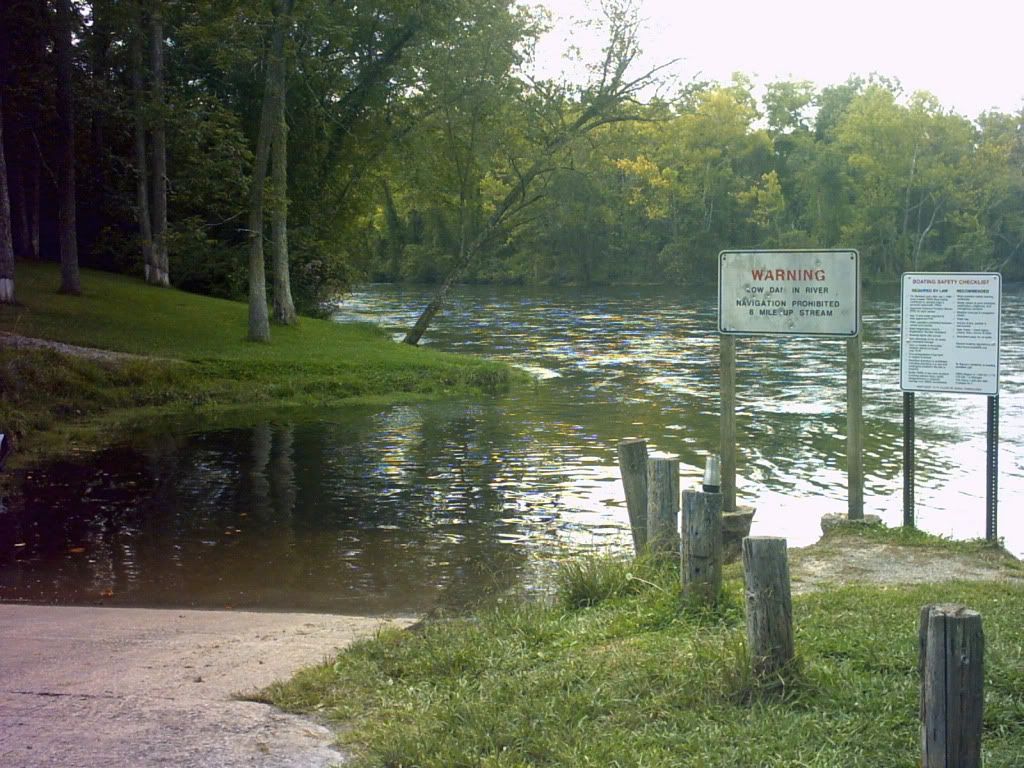 The second one was taken today. Notice the water level difference. The dam is sluicing which means full generation and also allowing water to pass through bottom discharges. 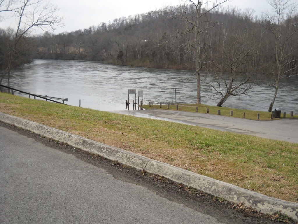 The third picture is of a small herd of deer that browse below the dam. On some days you can see several dozen in the fields. This show was about a quarter mile away from me. 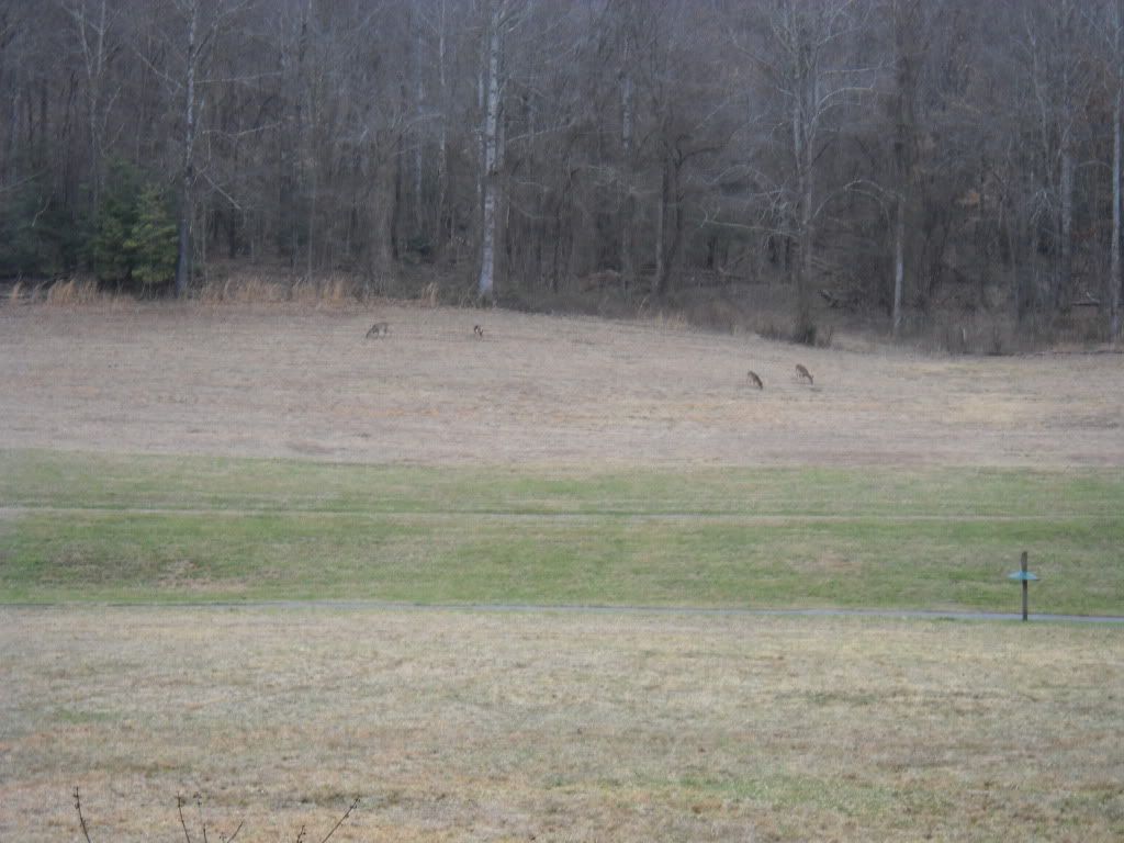 |
|
|
|
Post by caretaker on Feb 13, 2010 20:51:20 GMT -6
Last time I was up there the river had come up over the lower road at the launch had water over it. It was shallow but suprising.
|
|
|
|
Post by ibugly on Feb 13, 2010 21:07:46 GMT -6
Yea Pappy says one time the handicap parking sign in the lower parking area. Some guys were fixing to launch and TVA Security came in and told them no way. I have two more pictures to put in Photobucket. Probably take me about 30 minutes or so..
|
|
|
|
Post by caretaker on Feb 13, 2010 21:13:18 GMT -6
ain`t no way I`d launch in that
|
|
|
|
Post by ibugly on Feb 13, 2010 21:20:58 GMT -6
I've seen boats this week up above the Weir Dam. Rivers been running like this since right before Christmas IIRC. Maybe a day or so with a break that's it.
|
|
|
|
Post by caretaker on Feb 13, 2010 21:43:20 GMT -6
Last time I remember the river not runnin was when I had the encounter wiff the duck hunters. didn`t even get a nibble.
|
|
|
|
Post by ibugly on Feb 13, 2010 21:45:40 GMT -6
The first picture I took last September. I think two generators were running under normal conditions that day. There is a handicap parking sign in front of the van. My dad said hsaw that sign underwater a few years back. 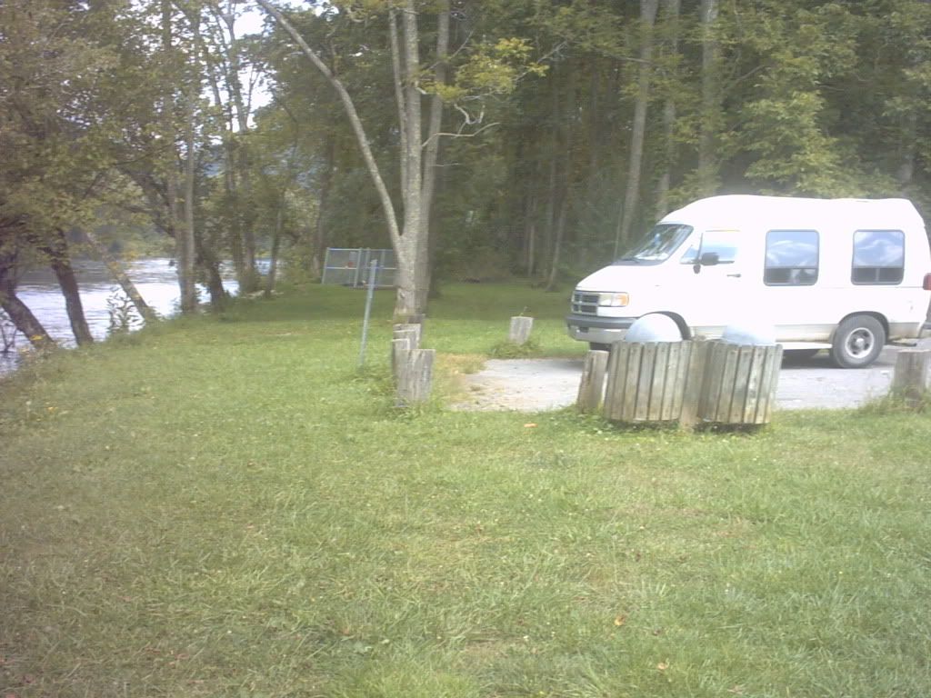 The second one I took this afternoon from a different angle. Notice the pumping station area in the two pictures. 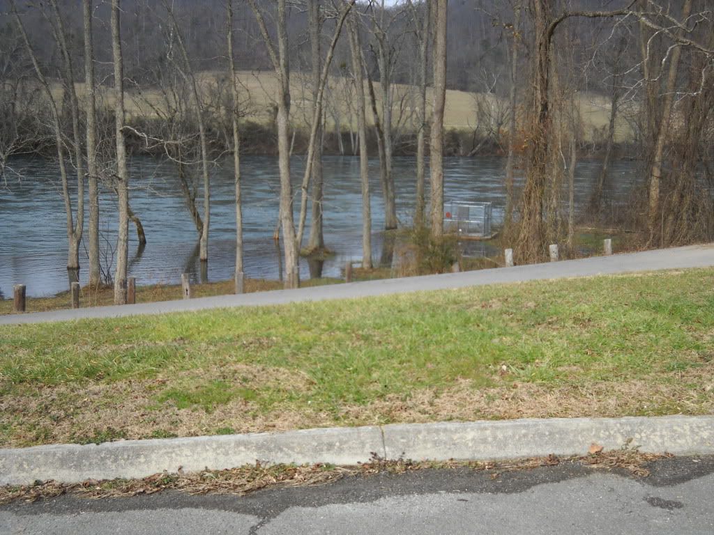 The second picture is full generation and sluicing. |
|
|
|
Post by caretaker on Feb 13, 2010 21:54:03 GMT -6
add a couple days of nonstop rain and run off and things get kinda damp around there. Great comparison pics
|
|
|
|
Post by ibugly on Feb 13, 2010 21:59:01 GMT -6
I'm up there almost every day now walking. Next big rain I'll watch and see. I think the time he saw it over the lower parking area was when Sharps Chapel road and 33 bridge were flooded by the lake. Any bets that it happens this spring?
|
|
|
|
Post by caretaker on Feb 13, 2010 22:13:10 GMT -6
Nope
|
|